- Screen Reader Access
- Skip to : main content / navigation
-
- Text Size
- Home
- Sitemap
- Contact us
- हिंदी




Environmental Systems Research Institute (ESRI) annually conducts a user conference, which provides a platform for ArcGIS users to gather and share ideas related to their respective fields and domains of work. This year, the user conference was held at New Delhi from 9th to 11th Dec 2014 at Kempinski Hotel wherein users presented their research works under the topics of Natural Resource Management, Disaster Management, Water Resource Management, New Technology and Urban & Infrastructure.
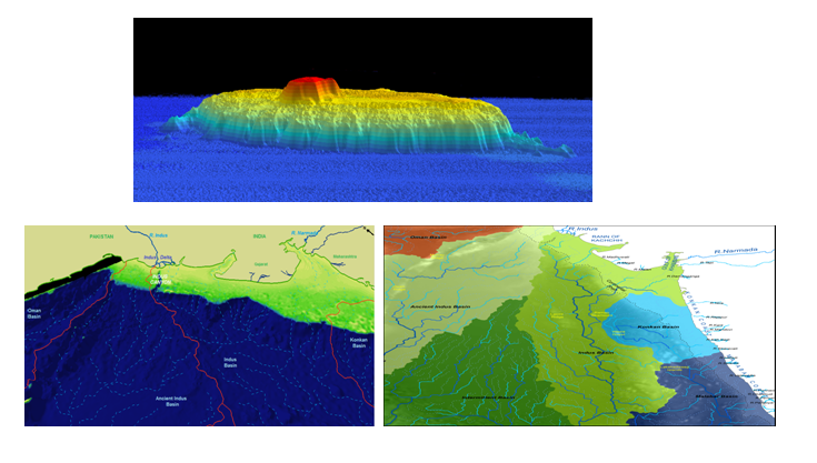
A recently completed study on deep sea channels was presented at the conference under the theme of New Technology. The paper titled “A study of deep sea channels in the Arabian Sea: a GIS approach”, authored by Prerna R., Dhananjai K. Pandey and Ravi Mishra was awarded the 2nd runner-up position for Best Student Paper Presentation. This research highlights the linkage of deep sea channels identified using multibeam swath bathymetry data in the middle Indus fan to the submarine Indus canyon – in this case, the source feeder of sediments. The study interested the GIS user community as it showcased the capability of Hydrology tools available in the ArcGIS software package especially designed for analysing drainage patterns/network. Currently this paper is under review in an international peer reviewed journal.
List of selected students for the internship at NCPOR for the Winter Session 2026.
NCPOR SHOWCASES INDIA’S POLAR AND OCEAN RESEARCH AT IGU 2026.
Cleanliness is not just a campaign; it is a collective responsibility.
NCPOR AT ESTIC 2026 | ADVANCING OCEAN SCIENCE AND MARITIME TECHNOLOGIES.
Vigilance Awareness Week 2026 at NCPOR | Probity for Prosperity

